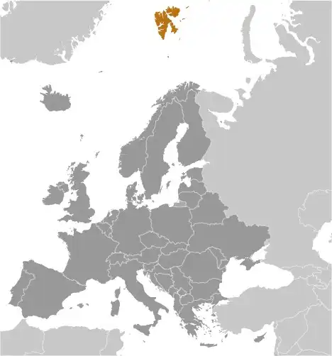
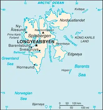
Svalbard and Jan Mayen
Veröffentlicht: 20. June 2022 - Letztes Update: 28. February 2025
Country Data Dashboard
Population
2,926 (2021 est.)
Growth: -0.03% (2019 est.)
GDP
no data
Area
62,045 sq km
| Government type: | non-self-governing territory of Norway |
| Capital: | Longyearbyen |
| Languages: | Norwegian, Russian |
People & Society
Ethnicity (2021 est.)
Age structure
No image available.
Economy
Economic overview
high-income Norwegian island economy; major coal mining, tourism, and research sectors; recently established northernmost brewery; key whaling and fishing base; home to the Global Seed Vault
Real GDP (purchasing power parity) in Billion $
no data
Real GDP per capita in $
No data
Geography
Map
Area
Natural resources
- coal ⚫
- iron ore ⛓️
- copper 🟧🪙
- zinc 🔩
- phosphate 🧪
- wildlife 🐾
- fish 🐟
Climate
arctic, tempered by warm North Atlantic Current; cool summers, cold winters; North Atlantic Current flows along west and north coasts of Spitsbergen, keeping water open and navigable most of the year
Historical Background Information
Norse explorers may have first discovered the Svalbard archipelago in the 12th century. The islands served as an international whaling base during the 17th and 18th centuries. Norway's sovereignty was internationally recognized by treaty in 1920, and five years later Norway officially took over the territory. Coal mining started in the 20th century, and a Norwegian company and a Russian company are still in operation today. Travel between the settlements is accomplished with snowmobiles, aircraft, and boats.