Guernsey
Veröffentlicht: 18. June 2022 - Letztes Update: 28. February 2025
Country Data Dashboard
Population
67,787
Growth: 0.21% (2024 est.)
GDP
$12.508 billion
(2023 est.)
Area
78 sq km
| Government type: | parliamentary democracy (States of Deliberation) |
| Capital: | Saint Peter Port |
| Languages: | English, French, Norman-French dialect spoken in country districts |
People & Society
Ethnicity (2022 est.)
Religion (Anglican, Presbyterian, Baptist, Congregational, Methodist)
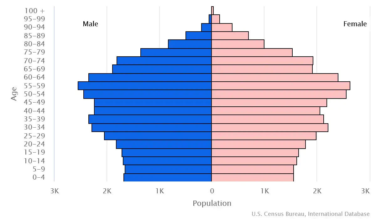
Age structure
Economy
Economic overview
high-income English Channel island economy; strong financial sector but stressed due to COVID-19 disruptions; manufacturing, tourism, and construction industries suffered but expected to recover; stable inflation; maintains independent taxation authority
Real GDP (purchasing power parity) in Billion $
Real GDP per capita in $
Top 5 Import Partner in 2022 (0%)
Top 5 Import Commodities in 2022
- ships 🚢
- aircraft ✈️
- refined petroleum ⛽
- mineral manufactures 🪨
- beverages 🥤
Top 5 Export Partner in 2022 (0%)
Top 5 Export Commodities in 2022
- aircraft ✈️
- photo lab equipment 📷
- clocks 🕰️
- ships 🚢
- paintings 🪙
- scientific instruments 🔬
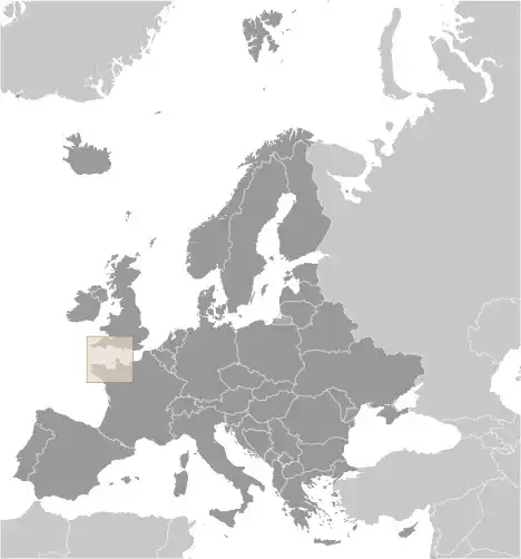
Geography
Map
Area
Natural resources
- cropland 🌾
Climate
temperate with mild winters and cool summers; about 50% of days are overcast
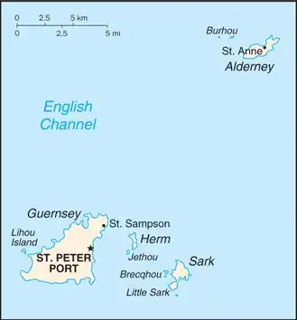
Historical Background Information
Guernsey and the other Channel Islands represent the last remnants of the medieval Duchy of Normandy, which held sway in both France and England. The islands were the only British soil that Germany occupied in World War II. The Bailiwick of Guernsey consists of the main island of Guernsey and a number of smaller islands, including Alderney, Sark, Herm, Jethou, Brecqhou, and Lihou. The Bailiwick is a self-governing British Crown dependency that is not part of the UK. However, the UK Government is constitutionally responsible for its defense and international representation.