American Samoa
Country Data Dashboard
| Government type: | unincorporated, unorganized Territory of the US with local self-government; republican form of territorial government with separate executive, legislative, and judicial branches |
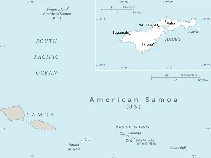
| Capital: | Pago Pago |
| Languages: | Samoan 87.9% (closely related to Hawaiian and other Polynesian languages), English 3.3%, Tongan 2.1%, other Pacific Islander 4.1%, Asian languages 2.1%, other 0.5% (2020 est.) |
People & Society
Ethnicity (2020 est.)
Religion (2020 est.)
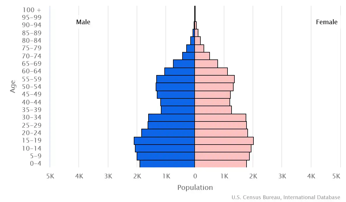
Age structure
Economy
Economic overview
tourism, tuna, and government services-based territorial economy; sustained economic decline; vulnerable tuna canning industry; large territorial government presence; minimum wage increases to rise to federal standards by 2036
Real GDP (purchasing power parity) in Billion $
Real GDP per capita in $
Exports & Imports in million $
Top 5 Import Partner in 2022 (81%)
Top 5 Import Commodities in 2022
- refined petroleum ⛽
- fish 🐟
- cars 🚗
- paper containers 📄
- wood 🌲
Top 5 Export Partner in 2022 (81%)
Top 5 Export Commodities in 2022
- animal meal 🍖
- packaged medicine 💊
- machinery ⚙️
- refined petroleum ⛽
- insulated wire 🔌
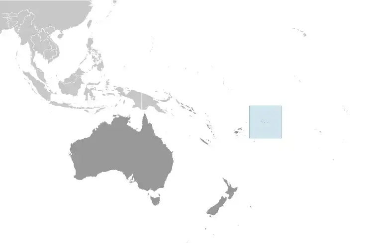
Geography
Map
Area
Natural resources
- pumice 🪨
- pumicite 🪨
Climate
tropical marine, moderated by southeast trade winds; annual rainfall averages about 3 m; rainy season (November to April), dry season (May to October); little seasonal temperature variation
Historical Background Information
Tutuila -- the largest island in American Samoa -- was settled by 1000 B.C., and the island served as a refuge for exiled chiefs and defeated warriors from the other Samoan islands. The Manu’a Islands, which are also now part of American Samoa, developed a traditional chiefdom that maintained autonomy by controlling oceanic trade. In 1722, Dutch explorer Jacob ROGGEVEEN was the first European to sail through the Manu’a Islands, and he was followed by French explorer Louis Antoine DE BOUGAINVILLE in 1768. Whalers and missionaries arrived in American Samoa in the 1830s, but American and European traders tended to favor the port in Apia -- now in independent Samoa -- over the smaller and less-developed Pago Pago on Tutuila. In the mid-1800s, a dispute arose in Samoa over control of the Samoan archipelago, with different chiefs gaining support from Germany, the UK, and the US. In 1872, the high chief of Tutuila offered the US exclusive rights to Pago Pago in return for US protection, but the US rejected this offer. As fighting resumed, the US agreed to the chief’s request in 1878 and set up a coaling station at Pago Pago. In 1899, with continued disputes over succession, Germany and the US agreed to divide the Samoan islands, while the UK withdrew its claims in exchange for parts of the Solomon Islands. Local chiefs on Tutuila formally ceded their land to the US in 1900, followed by the chief of Manu’a in 1904. The territory was officially named “American Samoa” in 1911.
The US administered the territory through the Department of the Navy. In 1949, there was an attempt to organize the territory, granting it formal self-government, but local chiefs helped defeat the measure in the US Congress. Administration was transferred to the Department of the Interior in 1951, and in 1967, American Samoa adopted a constitution that provides significant protections for traditional Samoan land-tenure rules, language, and culture. In 1977, after four attempts, voters approved a measure to directly elect their governor. Nevertheless, American Samoa officially remains an unorganized territory, and people born in American Samoa are US nationals rather than US citizens.